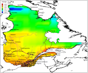
The project delivered a medium resolution solar resource map set of Quebec (province-wide) based on long-term solar climatology data showing average yearly and monthly radiation. Five target areas with the greatest potential for solar power project development were identified. Our high resolution solar resource mapping of these 100 x 100 km areas provided insolation values on latitude-tilted and optimally-tilted surfaces, demonstrating the locations with significant resource potential within these areas. Various PV technologies were evaluated for their electrical generation potential at the specific sites.
![]()
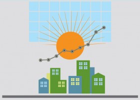
For decision-makers for energy applications, Green Power Labs is a software-as-a-service provider with the predictive energy analytics expertise to enable superior control in managing smart energy generation and consumption.
Our scientific depth and practical know-how is realized in automated predictive analytics solutions for smart energy management.

Green Power Labs represents Canada on the International Energy Agency Task Force 46 Solar Resource Assessment and Forecasting and Task Force 51 Solar Energy in Urban Planning.
We are actively involved in industry groups including the Utility Variable-Generation Integration Group, Canadian Solar Industries Association and have presented at industry related conferences in Canada, US, Europe and Asia.
![]()
Is your rooftop solar friendly?
Check here